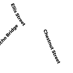
947-949 CHESTNUT ST 947-2
Owner Information
BAI XIAOBO
947 CHESTNUT ST 947-2
NEWTON, MA 02464


Property Details
947-949 CHESTNUT ST 947-2 is classified as a Residential Condominium (Three family).
The primary structure on this property was built in 1900. There are 1,190ft2 of built area within this property. There is 1,190ft2 of residential/living space within this property. This property is listed as having 5 rooms.
947-949 CHESTNUT ST 947-2 is valued at $507,000. The land is valued at $0 and the structures are valued at $507,000.
This property is in Zone MR1. Confirm with local Zoning Board authorities to ensure there are no overlays or other easements on this property.
The most recent deed for 947-949 CHESTNUT ST 947-2 is recorded at the local registrar in Book 71314, Page 394. 947-949 CHESTNUT ST 947-2 was last sold on Friday, July 13, 2018 for $545,000.
Assessment data from fiscal year 2022.
Flood Data
According to the FEMA National Flood Hazard Layer, this property does not appear to be in a flood zone. It may also be in an area not yet reviewed. Nonetheless, confirm this information prior to taking any action.
To view the flood hazards around this property, create a FEMA "Firmette" Map of the area around 947-949 CHESTNUT ST 947-2.
Broadband Internet Providers
| Provider | Type | Bandwidth (mbps) | |
|---|---|---|---|
| Verizon New England Inc. | DSL | 5 | 0 |
| Crown Castle Fiber | Fiber | 0 | 0 |
| VSAT Systems, LLC. | Satellite | 2 | 1 |
| HughesNet | Satellite | 25 | 3 |
| GCI Communication Corp. | Satellite | 0 | 0 |
| RCN | Cable | 1000 | 20 |
| RCN | Cable | 500 | 20 |
| Comcast | Cable | 1000 | 35 |
| Verizon New England Inc. | Fiber | 940 | 880 |
| Viasat Inc | Satellite | 100 | 3 |
Broadband service provider data from December 2020.
Adjacent Properties
- 14 ELLIS ST
Single Family Residential owned by AGHAJAN YASMIN - 6-8 ELLIS ST #6
Residential Condominium owned by KAHN BENJAMIN D & AMY B - 6-8 ELLIS ST #8
Residential Condominium owned by BHAGHNANI TARUN D - 6-8 ELLIS ST
Other, Open Space owned by 6-8 ELLIS ST MASTER DEED - 953 CHESTNUT ST
Single Family Residential owned by LIN KUNCHING - 943 CHESTNUT ST
Single Family Residential owned by PURDY JAMES C & SHEILA RUTH